Last checked Due a review
Key facts
- Duration
- 10 to 14 days on the trail from Jomsom
- Highest point
- 4,010 m (13,156 ft) at Near Lo La or Garphu (3,950 m) with optional day hikes higher
- Total distance
- 155 km
- Difficulty
- Moderate, 2 of 5
- Best months
- March to October
- Months to avoid
- January and December
- Starts and ends
- Jomsom (2,720 m) via flight from Pokhara or drive from Pokhara to Jomsom
- Accommodation
- Teahouse lodges
- Permits
- Upper Mustang Restricted Area Permit, Annapurna Conservation Area Permit (ACAP)
- Typical cost
- $2,500 to $4,500 per person, guided
- Experience needed
- Some trekking experience is recommended but no high-altitude experience is required for the standard route.
Why is Upper Mustang trekable during monsoon?
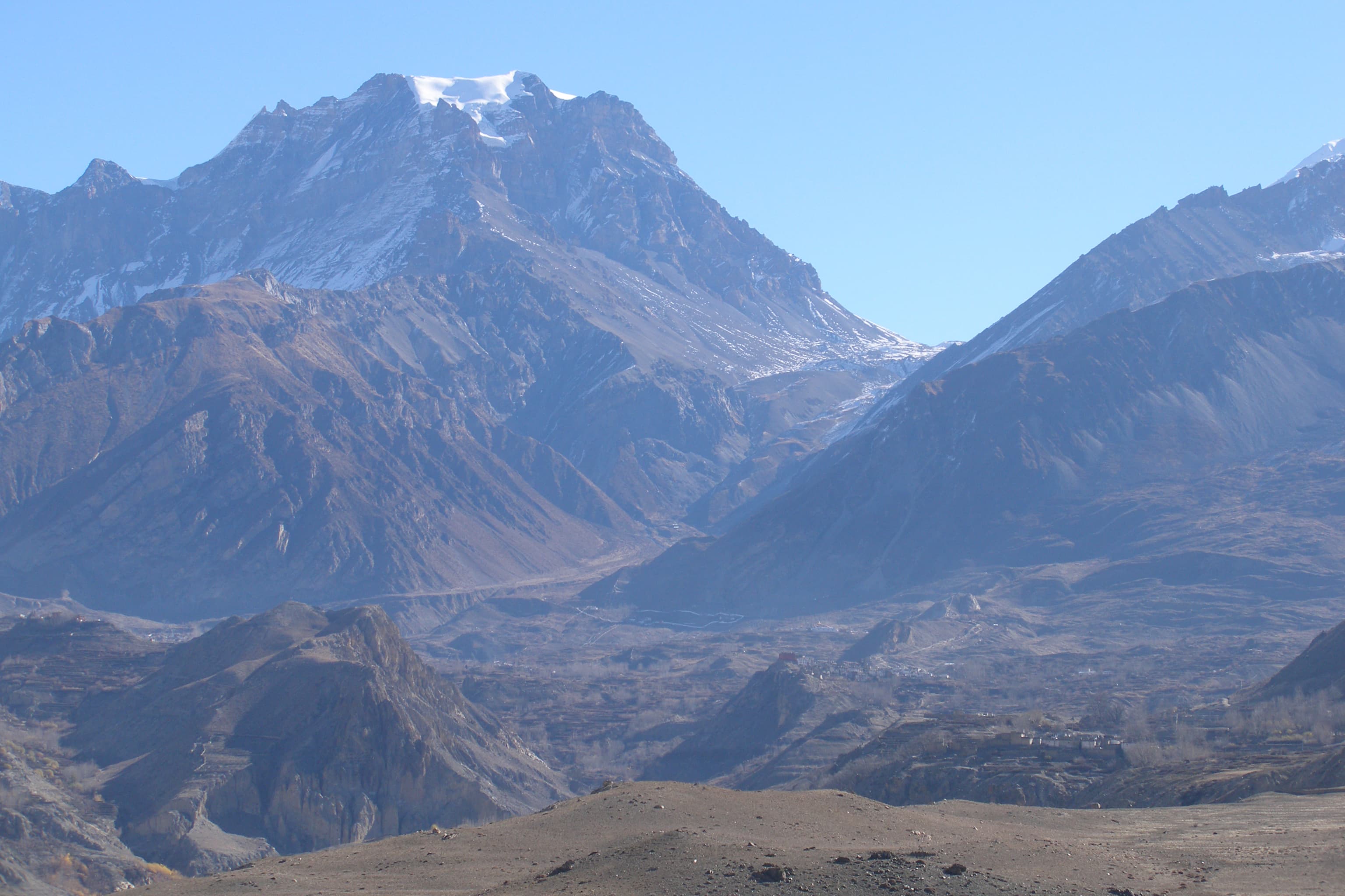
Upper Mustang lies in the Himalayan rain shadow north of Annapurna and Dhaulagiri. While southern Nepal is drenched in monsoon rain from June to August, Upper Mustang receives almost none.
The Annapurna and Dhaulagiri ranges act as a giant barrier, intercepting the monsoon clouds coming from the Bay of Bengal before they reach the plateau to the north. Upper Mustang averages less than 300 mm of annual rainfall, compared to over 3,000 mm on the southern Himalayan slopes.
This makes Upper Mustang one of only a handful of Nepal trekking destinations that are genuinely accessible during the June to August monsoon period, when most other routes are muddy, leechy, and obscured by cloud.
The trade-off is strong dust-laden wind, particularly in June and July, and some road sections that can become muddy in a heavy year.
Is the Upper Mustang permit worth the cost?
At USD 50 per day, Upper Mustang is one of the most expensive trekking destinations in Nepal. Whether it is worth it depends entirely on what you are seeking.
The cost is genuine. A 10-day permit is USD 500 per person, plus all the standard trekking costs. This price point filters the trekking population: Upper Mustang is never crowded, the teahouses are quieter, and the cultural experience is more intimate.
For people whose primary interest is Buddhist art, medieval architecture, and trans-Himalayan culture rather than peak-bagging or dramatic landscapes, Upper Mustang is without equal in the accessible Nepal trekking circuit.
For those primarily interested in high passes and dramatic mountain views, the Manaslu Circuit or Khumbu region offers more dramatic mountain scenery at lower cost.
Upper Mustang Trek itinerary, day by day
The full 12 day schedule, with sleeping altitude, walking hours and overnight stop for every day. The acclimatisation days are the ones that decide whether people finish.
Day 1
Pokhara to Jomsom by flight, then Kagbeni
- 2,810 m
- Rest day
- 90 km
- 3 to 4 h
- Sleep: Kagbeni
Fly to Jomsom then walk along the Kali Gandaki to the historic gateway village of Kagbeni.
Read the dayShow less
Morning flights to Jomsom depart Pokhara before 9am to beat the valley winds. From Jomsom, walk 12 km to Kagbeni. The walled village of Kagbeni marks the southern boundary of the restricted Upper Mustang zone. Permits are checked here.
Transport: Flight Pokhara to Jomsom (25 min), then trekking to Kagbeni
Highlight: Enter the Kali Gandaki gorge, the deepest gorge on earth
Day 2
Kagbeni to Chele
- 3,050 m
- Up 240 m
- 14 km
- 5 to 6 h
- Sleep: Chele
Enter Upper Mustang past the permit checkpost. The landscape changes immediately to an arid, wind-eroded moonscape.
Read the dayShow less
Cross the Kagbeni checkpoint and enter the restricted zone. The trail climbs above the Kali Gandaki into the distinctive red-cliffed landscape of Upper Mustang. The colours of the eroded cliffs shift from brown to red to white. Chele is the first village of any size inside the upper zone.
Day 3
Chele to Syangboche
- 3,800 m
- Up 750 m
- 16 km
- 6 to 7 h
- Sleep: Syangboche
Cross high passes through an increasingly surreal eroded landscape.
Read the dayShow less
The trail crosses two high passes — Taklam La (3,624 m) and Dajori La (3,735 m). Views of the Nilgiri, Tilicho, and Annapurna range to the south and the endless plateau of Tibet to the north.
Day 4
Syangboche to Ghami
- 3,520 m
- Down 280 m
- 14 km
- 5 to 6 h
- Sleep: Ghami
Descend into the Ghami valley. Ancient chortens and mani walls line the trail.
Read the dayShow less
The Ghami mani wall is one of the longest in Nepal. The village has a gompa with 15th century frescoes, rarely seen by outsiders.
Day 5
Ghami to Tsarang
- 3,660 m
- Up 140 m
- 12 km
- 4 to 5 h
- Sleep: Tsarang
Approach the heartland of the old kingdom. Tsarang's dzong (fort) dominates the valley.
Read the dayShow less
Tsarang was the seat of the second most powerful family in the old Lo Kingdom. The dzong and monastery date from the 14th century and contain rare thangka paintings.
Day 6
Tsarang to Lo Manthang
- 3,840 m
- Up 180 m
- 12 km
- 4 to 5 h
- Sleep: Lo Manthang
Arrive at the walled capital of the former Kingdom of Lo.
Read the dayShow less
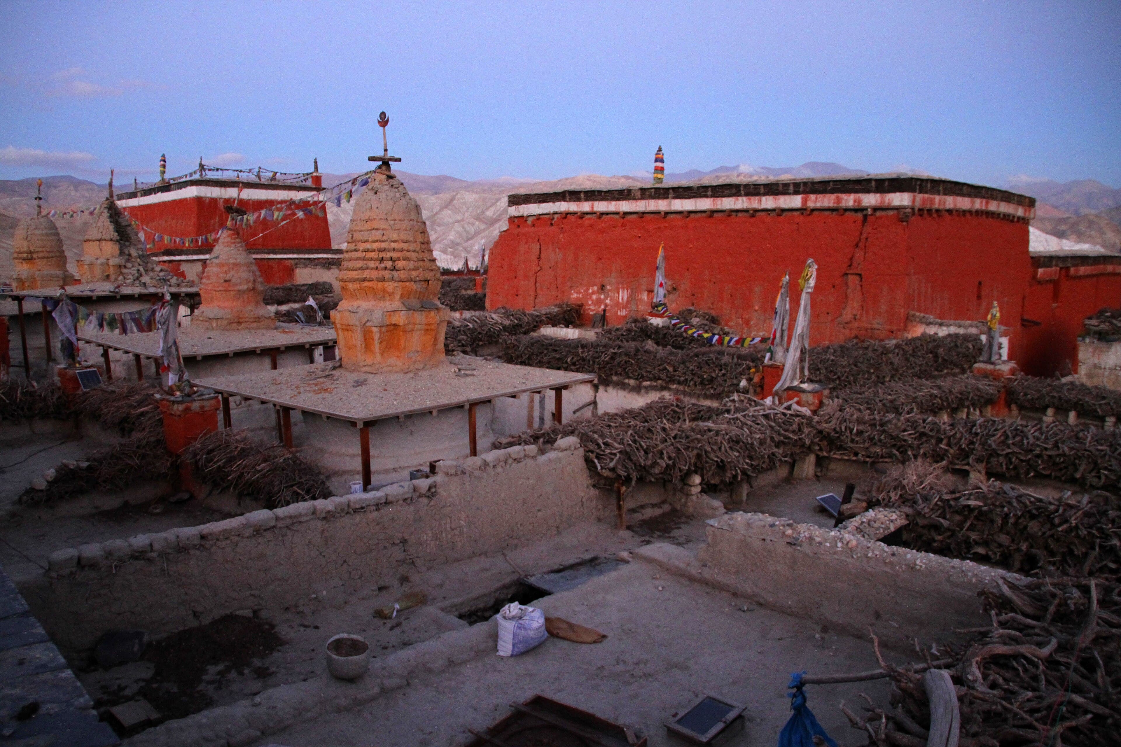
Lo Manthang's white walls appear suddenly in the barren plateau. The capital has four main temples — Jampa Lhakhang, Thugchen Lhakhang, Choede Lhakhang, and Chodak Gompa — all with extraordinary medieval frescoes. The King of Lo (the Loba Raja) continues to reside here.
Highlight: Lo Manthang, the walled capital of the former Kingdom of Lo
Day 7
Exploration Day in Lo Manthang
- 4,010 m
- Up 170 m
- 10 km
- 3 to 4 h
- Sleep: Lo Manthang
Full day to explore Lo Manthang and optional hike to the sky caves at Chungsi.
Read the dayShow less
Spend the morning inside the walled city visiting the temples with a local guide. In the afternoon, hike to the cliff-face cave complex at Chungsi, where hermit monks have practised retreat for centuries. Optional: hike to the local monastery above the village for panoramic views.
Day 8
Lo Manthang to Drakmar
- 3,810 m
- Down 30 m
- 18 km
- 5 to 6 h
- Sleep: Drakmar
Return south by a different route through the red cliff country.
Read the dayShow less
Take the alternative return route via Drakmar (red rock), offering different cliff formations and the Luri Gompa cave monastery above the valley. The landscape on the return is consistently dramatic.
Day 9
Drakmar to Ghami
- 3,520 m
- Down 290 m
- 15 km
- 5 to 6 h
- Sleep: Ghami
Continue south through the barren plateau.
Read the dayShow less
The return route through the plateau reveals different angles on the same extraordinary landscape. Wind is usually strong in the afternoons.
Day 10
Ghami to Chele
- 3,050 m
- Down 470 m
- 16 km
- 5 to 6 h
- Sleep: Chele
Descend from the plateau back toward the Kali Gandaki valley.
Read the dayShow less
The descent from the high plateau back toward the river valley reveals the dramatic transition between the arid trans-Himalayan zone and the wetter southern slopes.
Day 11
Chele to Kagbeni to Jomsom
- 2,720 m
- Down 330 m
- 22 km
- 6 to 7 h
- Sleep: Jomsom
Exit the restricted zone at Kagbeni and return to Jomsom.
Read the dayShow less
Pass through Kagbeni checkpoint to exit the restricted zone. Continue to Jomsom along the Kali Gandaki. Arrange flight or jeep back to Pokhara for the following morning.
Day 12
Jomsom to Pokhara
- 827 m
- Down 1,893 m
- 150 km
- Sleep: Pokhara
Fly or drive back to Pokhara from Jomsom.
Read the dayShow less
Morning flights to Pokhara are most reliable. Book ahead in the high season. If flights are cancelled due to weather, be prepared for the long jeep option via Beni.
Transport: Flight (25 min) or jeep (8 to 10 hours) to Pokhara
What is included and what is not
The altitude is not extreme by Himalayan standards. The terrain is mostly good trail with some exposed rocky sections. The challenge is the remoteness, wind, and the bureaucratic requirements.
Included in a guided price
Restricted Area Permitabout $$600 for 12 days
USD 50/person/day Upper Mustang RAP
ACAP permitabout $$20
Annapurna Conservation Area Permit
Teahouse accommodationabout $$110–165
11 nights twin-share
Mealsabout $$100–150
Breakfast and dinner on trail
Licensed guideabout $$280–400
Mandatory licensed guide with Mustang knowledge
Porterabout $$160–220
One per two trekkers
Not included, budget for it
Jomsom flights
Pokhara to Jomsom and return (approximately USD 180–220 per person round trip)
International flights
To and from Kathmandu or Pokhara
Travel insurance
Must cover remote area evacuation
Permits for the Upper Mustang Trek
Upper Mustang Restricted Area Permit
Issued by Department of Immigration, Nepal
As of late 2025: USD 50 per person per day (10-day minimum requirement removed). Must be obtained through a registered trekking agency. A licensed guide is mandatory.
Annapurna Conservation Area Permit (ACAP)
Issued by National Trust for Nature Conservation
- Foreign
- NPR 3,000
- SAARC
- NPR 1,500
Required for passage through the Jomsom area. Obtainable in Pokhara or at the Jomsom checkpost.
What to pack
Moderate fitness for 5 to 6 hours of walking per day in dry, windy conditions. The altitude rarely exceeds 4,000 m on the standard route, making it accessible to most reasonably fit trekkers.
Clothing
- Lightweight down jacket
- Fleece mid-layer
- Windproof shell jacket (critical for Mustang winds)
- Warm hat
- Sun hat
- Sunglasses (UV400)
Footwear
- Comfortable waterproof trekking boots
- Camp sandals
- 3 to 4 pairs trekking socks
Sun protection
- SPF 50+ sunscreen
- Lip balm SPF 30+
- Lightweight long-sleeve sun shirts (critical at altitude)
Equipment
- Trekking poles (useful for wind stability)
- Sleeping bag -5°C to -10°C
- Daypack 20 to 25 L
- Headtorch
- Dust bandana or buff
Frequently asked questions
Sources checked
- Department of Immigration NepalGovernment of Nepal, checked 20 January 2025
Fees and regulations in Nepal change. This page was last verified on 20 January 2025.